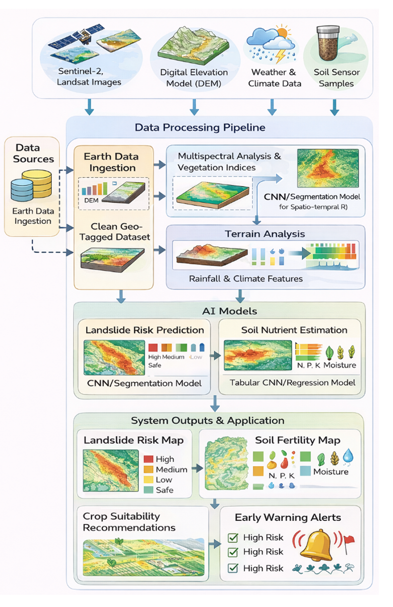
AI-Based Landslide Prediction and Soil Intelligence using Satellite Remote Sensing

AI Satellite image Landlide prediction Soil intelligence
Geospatial intelligence hero

Predict Risk. Protect Landscapes. Empower Decisions.

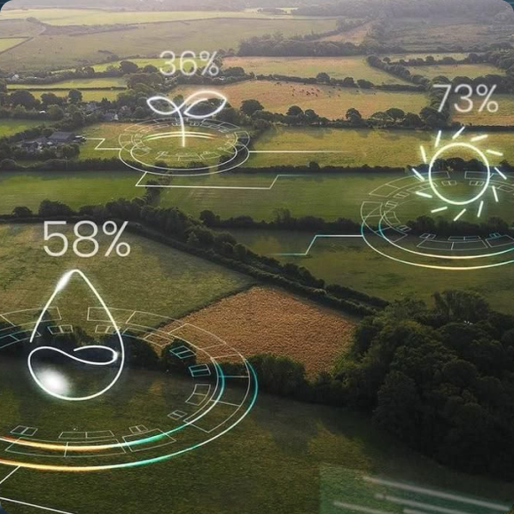
A GeoAI-powered remote sensing platform that combines terrain, climate, and satellite intelligence to forecast landslide risks and deliver actionable soil insights.

Multi-Source

Data Integration

Satellite, DEM, Rainfall, Climate

NDVI / EVI

Vegetation Index Analysis

For soil health estimation

Risk-Zoned

Spatial Prediction Maps

High / Medium / Low Susceptibility

Geospatial system overview

SAB's AI Landslide Prediction System

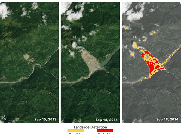
We designed an AI-powered GeoAI system for landslide risk prediction and soil intelligence using satellite and environmental data.

The system integrates satellite imagery, terrain elevation models, weather patterns, and multispectral analysis to deliver predictive risk mapping and soil health insights for proactive environmental management.

Challenge:

  • Difficulty in detecting early terrain instability and surface landscape changes from satellite imagery.
  • Limited availability of real imagery to identify hidden environmental risk indicators such as lithology, lithofacies, and lineaments.
  • High uncertainty caused by seasonal illumination and environmental changes in observation data.
  • Large-scale geospatial data processing leading to high computational cost and long training time.
  • Requirement for precise spatial prediction, including risk zonation and soil condition mapping.
  • Need for a scalable system capable of covering wide geographic regions in near real time.
Geospatial challenge
Geospatial solution

Solution:

  • Developed a GeoAI learning-based framework combining satellite imagery, DEM-derived elevation data, historical records, and weather indicators for landslide susceptibility prediction.
  • Incorporated multispectral satellite analysis with vegetation indices such as NDVI and EVI to estimate vegetation health and nutrient distribution.
  • Utilized multi-source machine learning models that fuse rainfall, terrain, and environmental data for improved prediction accuracy.
  • Generated spatial risk maps and soil fertility insights, enabling resourceful outputs for disaster prevention and agricultural planning.
  • Designed a scalable and deployable AI pipeline suitable for real-world environmental monitoring applications.

Let's Predict Environmental Risk with Intelligent Earth AI

Schedule a Demo